The map
Every location with coordinates, on one map.
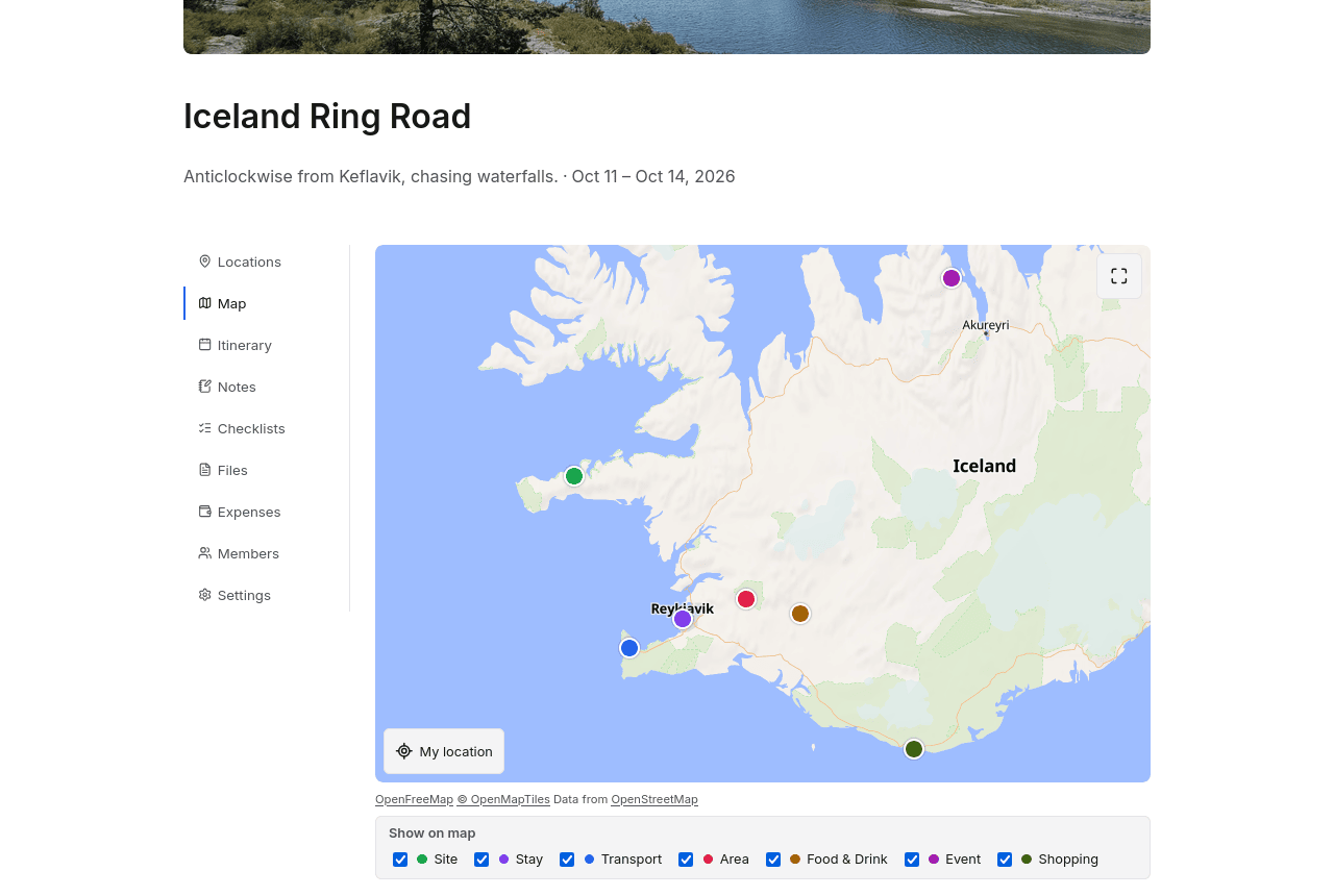
Pins are coloured by category — site, stay, transport, area, food & drink, event, shopping. Under the map, Show on map switches any category off, so "show me only where we are sleeping" is one click. The map frames itself to fit whatever is currently shown.
The map is drawn in your browser from OpenStreetMap data, which means the labels follow your language: the same trip reads Tokyo for an English reader and Tokio for a German one, at the same time on the same instance. It also comes in light and dark, independently of the rest of the app. By default it follows the actual position of the sun over wherever the map is showing, rather than your operating system's idea of evening — so a map of Iceland in June stays light at 23:00, and one of Chile in the same session does not. Both live in Settings → Appearance; the provider itself is configurable too, see Map style. Clicking a pin opens the location, so the map doubles as a way of navigating the trip rather than only a way of looking at it.
Getting coordinates onto a location
Three ways, in the order most people use them:
- Search for the address. The location editor looks it up and fills in the coordinates. This runs through Caravel's own server rather than from your browser — see Address search.
- Type them. Paste a latitude and longitude from wherever you found them.
- Let the assistant propose an address, then accept it. It never invents coordinates: it suggests an address and the geocoder resolves it. See The assistant.
A location can also be deliberately kept off the map even when it has coordinates, for something like a home airport you do not want framing the view.
Where you are
My location, in the map's bottom-left corner, shows your own position and keeps following it while the map is open. Press it again after panning away to come back. It needs the page to be served over HTTPS; over plain HTTP the browser will not hand out a position, and the button says so rather than waiting forever.
What the marker shows:
- The dot is where you are. The faint ring around it is how sure the device is, so a large ring means a rough guess. A rough position is also spelled out under the map.
- An arrow replaces the dot once you are moving at walking pace or faster, pointing the way you are going. It comes from GPS, so it shows your path, not where the phone points, and it turns back into a dot when you stop.
- A translucent cone shows which way the phone is facing, from its compass, whether you are moving or not. On an iPhone it is wider when the compass is unsure of itself.
So "walking north, looking east" is an arrow pointing up with the cone off to the right.
A phone without a compass, or one where you declined access to it, simply shows no cone; the rest works the same. On an iPhone, the first press asks two questions in a row, one for motion and orientation and one for your location. The cone needs a yes to the first.
A phone compass is easily thrown off indoors, in a car, or near metal and magnets (including some phone cases). If the cone points somewhere implausible, moving the phone in a figure-eight a few times usually recalibrates it.
On a phone
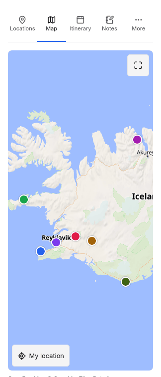
The tab row collapses to icons with a More menu, and the map gets the rest of the screen. The category filter sits below the map, under the map credit, so it never takes space from the map itself — scroll past the map to reach it.